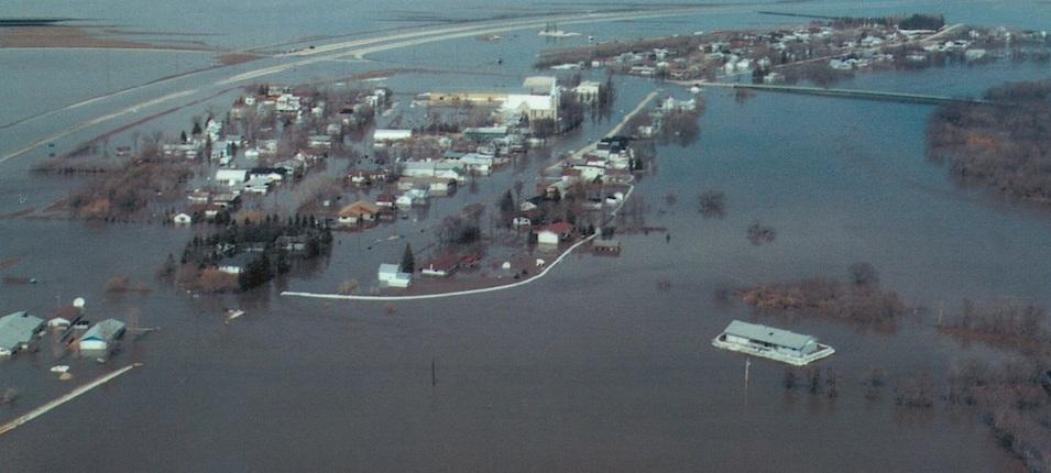
Long-term residents living in the Red River Valley have grown accustomed to the inconveniences of spring flooding. But if you’re new to the area, and a lot of people are, it’s always a good idea to brush up on the facts before a flood event occurs. In any type of emergency, preparation is key.
Most residents living in the communities of Niverville, Ste. Agathe, and St. Adolphe should have little to worry about in terms of saving their homes. Protective dikes around these communities have been fortified in the years since 1997, the year of the “flood of the century.” Dike heights have since been raised to two feet above 1997 water levels. Similarly, homeowners living outside the dikes were required to protect their properties to the same standards.
At best, commuters can expect to plan a new route for a few weeks, since certain road closures are inevitable. Highway 311 west has the potential for closure due to flooding, and Highway 200 will most certainly have submerged stretches.
At worst, if flood forecasts are relatively accurate, dike entrances along the west border of Niverville and south and north side of St. Adolphe may be filled in to block rising water. Niverville residents will exit and enter from Highway 311 east. Ste. Agathe and St. Adolphe residents should expect to travel via Highway 75.
At this stage, officials don’t believe the evacuation of homes or entire communities will be necessary.
The Town of Niverville and RM of Ritchot already have emergency response teams in place to mitigate the effects of flooding. Coordinators on each team work closely with the provincial Emergency Measures Organization (EMO).
Ritchot’s Emergency Response Measures
Ritchot’s Municipal Emergency Operation Centre is set up and active at the St. Adolphe fire hall. Emergency coordinator Harold Schlamp has been providing regular flood reports which are available on the RM’s website. Schlamp and volunteers will be available daily between the hours of 8:30 a.m. to 5:00 p.m. to field inquiries from residents.
Mayor Chris Ewen says that while evacuation of residents isn’t likely, there’s always the possibility that residents in low-lying areas will need to leave their homes.
“St. Adolphe is always a concern because it’s so close to the Red River,” Ewen says. “It’s the lowest point [in the RM]. That’s why the province graciously worked with us to create that ring dike expansion a couple of years ago.”
For both Ewen and Schlamp, overland flooding in areas without dike protection is a greater concern. Residents in these areas are being encouraged to take proactive steps to protect their properties. The RM already has a stock of 400,000 sandbags, the same number they had during the flood of 2009, which saw the highest levels of floodwaters since 1997.
“Due to weather conditions and delayed thaws along the Red, Rat, Seine, and La Salle Rivers, the sandbag delivery line will not be immediately operational,” states the RM’s current flood report. “Weather and river conditions will continue to be monitored and, once the thaw begins, we will start delivery.”
The report also contains a volunteer contact number should residents require assistance in filling sandbags and erecting a sand bag dike. Homeowners receiving aid are requested to provide food and drink for the volunteers as they work.
Historically speaking, Ewen says, the Grande Pointe area is typically affected by overland flooding first, although most of the floodwater is usually contained to agricultural farmland east of Highway 59 where no homes exist.
If evacuation measures need to be taken, the City of Winnipeg, working alongside the Province of Manitoba’s Emergency Social Services, will host Ritchot residents. Details on evacuation procedures will likewise be posted on the RM’s website in that event.
Rural property owners with driveways built below flood grade are expected to take proactive measures to ensure they will not be cut off from an operational roadway. Failing to do so will not qualify them for evacuation support.
“We’ve had very fortunate weather the last two weeks,” Ewen affirms. “It’s been warm during the day, relieving some of that moisture, and it’s been cold during the night, freezing it up. That’s a great thing. We just have to go day by day and make sure our emergency coordinator is watching the forecast and working with the province in getting the numbers.”
The RM’s website will continue to include flood updates as quickly as the province provides them. Ewen says RM staff will use its Connect app to notify residents of any dramatic changes to the current flood report.
Niverville’s Emergency Response Measures
“Council introduced a local Emergency Response Control Group that looks after all aspects of emergency preparedness,” says Niverville’s CAO Eric King, a member of the four-person team. “We have had monthly meetings to review our preparedness for this spring’s flood as well as other possibilities.”
King says that should the town’s dike need to be closed off, pumping equipment is ready and waiting to keep the town draining to the west as snow melts and precipitation falls. Equipment has already been actively put to work to clear snow within town limits as much as weather conditions have allowed.
“We are not concerned about a flood greater than our flood protection,” King says. He adds that properties outside the dike should maintain communication with their municipal representatives for further floodproofing.
He warns all travellers to stick to routes that are deemed safe by highway officials. Submerged highways pose a great risk as depth is difficult to judge and rapidly-moving water can wash a vehicle off the road.
“At this stage, unless the forecast gets worse, there is no anticipation of opening the Municipal Emergency Centre in Niverville,” King says. “Should people wish to help our neighbours, we would strongly encourage reaching out to the RM of Ritchot.”


